
Highlights
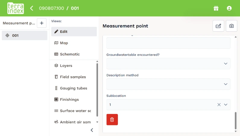
1. Sublocations automatically assigned in Field
When you place or move a measurement point on the map, TerraIndex Field now automatically assigns the sublocation it falls within. You no longer need to select it manually. If the point is outside all sublocations, the existing value remains unchanged. This also works offline.
2. New project map in TerraIndex Archaeology
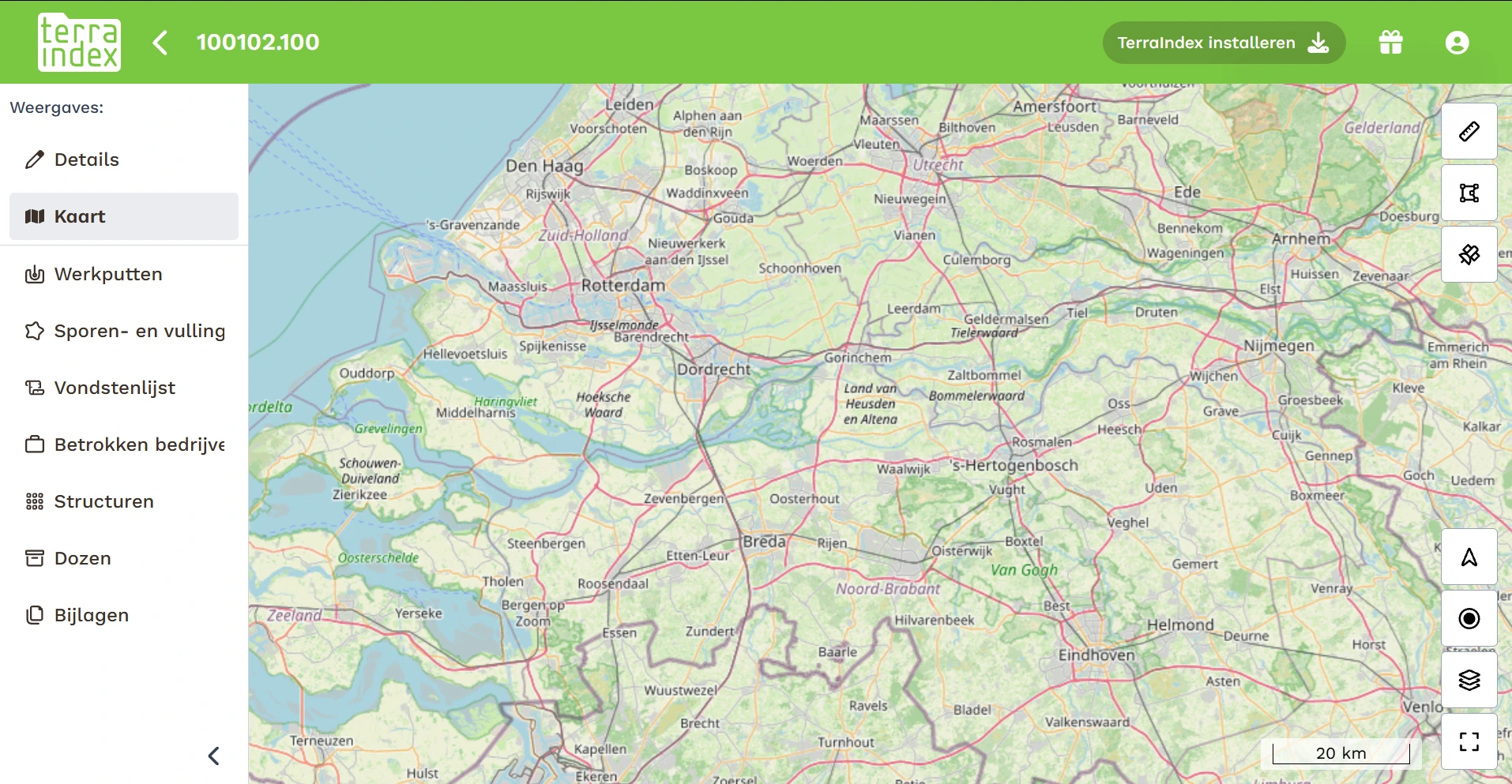
TerraIndex Archaeology now has a map at project level. This is the first step towards expanding the mapping features in Archaeology. More features will be added in the coming period.
3. New Mistral 9.0 export available
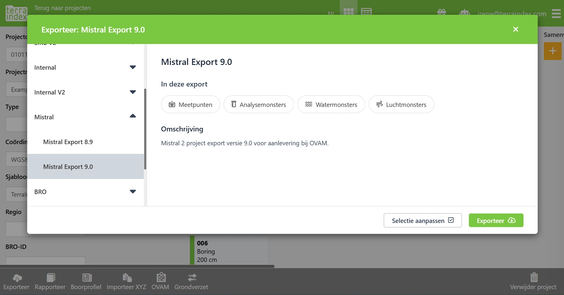
In addition to Mistral 8.9, TerraIndex now supports Mistral 9.0, in accordance with the new OVAM specification. Analysis samples are exported separately from field samples. The new 'Hoop' profile type is also supported, along with exporting leaching results as separate eluate samples.
New
Environmental Field
When you place or move a measurement point on the map, Field automatically fills in the sublocation it falls within. If the point is outside all sublocations, the existing value remains unchanged. This also works offline.
You can now scan QR codes with the barcode scanner, including those on the new Servaco bottles.
Envorionmental lab
You can now link multiple contacts to a single lab order. In the new field for additional email addresses, enter the addresses separated by semicolons. The addresses are validated, displayed in a separate column in the lab order overview and included in SIKB exports.
A new bottle list is available for Eurofins.
Environmental Reporting
You can now use PID Instrument (Reference) as a measurement point label on borehole logs, for reporting in accordance with NF X31-620.
Archaeology
You can now register structures, packaging and containers. Structures can be linked to features, finds to packaging, and packaging to containers. For containers, you can record information such as storage temperature, humidity, light sensitivity, fragility and hazardous substances. This information is included in the delivery note export.
Archaeology now has a map at project level. More features will be added to this map in the coming period.
Map
New French map layers from cartes.gouv.fr are available. Two layers have been added in Field, while Plan IGN and Photographies aériennes (IGN) are now available in Web.
Exports
In addition to the existing Mistral 8.9 export, Mistral 9.0 is now available in accordance with the new OVAM specification. Analysis samples are separated from field samples. The Vlarebo fields and asbestos fields for soil have been removed.
Improved
Environmental Field
The save icon and the warning displayed when leaving a screen without saving now reflect whether your data has actually been saved. On a slower tablet, the icon only disappears once your data has been stored.
In the Spanish translation, a monitoring well filter is now called 'Instalación' (plural: 'Instalaciones').
Archaeology
Treatment Method Details is now a multi-line free-text field, allowing up to 2,000 characters, instead of a dropdown list. The field is always visible.
Photos from a tablet are now synchronised in small batches. If one photo fails to upload, the others will continue. Previously, synchronisation could get stuck when uploading large numbers of photos.
Environmental Reporting
The Spanish report Tablas_Aguas_D now includes an additional tab, 'poco perm', for monitoring wells that ran dry during pre-pumping. It contains data from the three pumping and recovery phases, as well as groundwater levels. The 'permeable' tab only shows monitoring wells that did not run dry.
Map
When you zoom in beyond the scale at which a map layer is available, the last displayed map image remains visible instead of disappearing. Some layers are only displayed within a specific scale range, such as Adressen Brussel from approximately 1:1,500. This is determined by the map service itself.
Exports
For OVAM soil movement exports, the EBSD reference now appears at the top and defaults to the project code. You can change this reference yourself. The organisation number and company name must now be entered in the Soil Movement settings. These details apply to the entire company. Previously, a TerraIndex number and the name 'TerraIndex' were used.
The Mistral 9.0 export now also supports the new profile type 'Hoop'. Analysis samples with leaching results are exported as type Eluate. If an analysis sample contains both leaching results and regular analysis results, the leaching results are exported as a separate Eluate sample.
Other
The contracted number of licences is now displayed for a Field licence.
Fixed
Environmental Field
On Android phones, the menu remained open when navigating back. It now closes correctly.
Archaeology
When an error occurred, the synchronisation log of a local backup included the complete data of the affected item twice. The log now only contains the step and item name, allowing you to share a backup without including unnecessary project data.
Environmental Office
When manually importing a file containing analysis results, the associated lab order was not updated. This now works correctly.
Environmental Reporting
Some codes in the Spanish borehole logs were not translated. The missing translations have been added.
Environmental Lab
Reopening a lab order resulted in an error on screen 5. The screen now opens with the saved data.
When a project name was very long, information on screen 6 of the lab order was hidden behind the green block. All information is now readable.
Map
If a project contained multiple KLIC files with the same group name, you could no longer show or hide the map layers. This now works again.
Exports
Conversion and import jobs could produce empty files if an earlier job had generated a file with the same name. This has been resolved.
Other
News messages were not working. This has been resolved.
Good to know
- Sublocations after synchronisation: Measurement points previously created in Field with a sublocation may still appear in Web without that sublocation. Check this in existing projects.
- Sublocations when moving measurement points: When you move a measurement point on the map, Field replaces the previously selected sublocation with the sublocation the point now falls within.
- Archaeology – delivery note: If Feature Periods, Section Shape or Plan Shape are empty in Final and in both observations, the delivery note export generates an error.
- OVAM soil movement: Enter your organisation number and company name in the Soil Movement settings before creating your next export.
- Sublocations in lab orders: Measurement points that previously lost their sublocation when a lab order was updated may still have no sublocation assigned. Check these details in existing orders.
- Duplicate bottles: Water samples where a deleted bottle reappeared may not have been corrected yet. When submitting samples, check that the number of bottles is correct.
- Data conversion in Field: After the update, Field converts locally stored map data to a new format once. If you see a data conversion message during startup, do not refresh the page or close the app until the conversion has finished.
- Sending exports by email: The email button for exports has been temporarily removed because it was no longer working. Download the export and send the file yourself.
- Belgian map layers: The old layers Kadastrale percelen België, Urbis Brussel, Adrespunten Brussel and CRAB adressen Vlaanderen have been replaced by Kadastrale percelen Vlaanderen, Parcelles cadastrales Wallonie and Kadastrale percelen Brussel. If you used the old layers, enable the new ones.
- NEN-ISO 14688 in Field: Sand layers previously entered in Field may still generate an error in Web for Secondary Gradation 1. Adjust these layers in Web if necessary.
- Water samples under a monitoring well filter: Water samples that were previously transferred to Web as surface water samples may not have been corrected yet. Check existing water samples if you encountered this issue.
If you have any questions about these changes or need help using them, please contact our our service desk. Our team will be happy to help.